Cesta: OMA » Rakúsko » Gemeinde Orth an der Donau » Doprava » iná » bus

Gemeinde Orth an der Donau Doprava iná bus

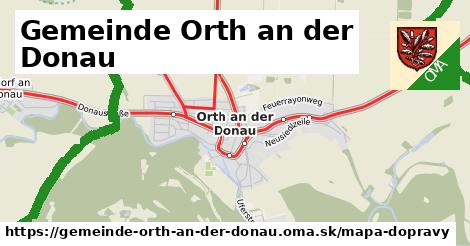
Mapa dopravy

ikona Mapa dopravy mapa-dopravy v gemeinde-orth-an-der-donau

Interaktívna mapa dopravy

zobraz si interaktívna mapa dopravy

Doprava od iná typu bus

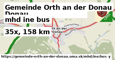
V Gemeinde Orth an der Donau prevádkuje iná 35 liniek dopravy typu bus, ktoré majú 158 km. Tieto sú tvorené dobrovoľníkmi ako ste vy. Môžete doplniť ďalšie.

Všetky Doprava od iná typu bus Slovenska.

Interaktívna mapa dopravy

Doprava od iná typu bus sa dajú nájsť aj cez regióny (napríklad pohorie alebo kraj).
Interaktívna mapa dopravy

Doprava od iná typu bus

V Gemeinde Orth an der Donau prevádkuje iná 35 liniek dopravy typu bus, ktoré majú 158 km.

  1. mhd Bus 545: Gänserndorf = > Haringsee 545
  2. mhd Bus 545: Haringsee = > Gänserndorf 545
  3. mhd Bus 545: Leopoldsdorf/Marchfeld = > Haringsee 545
  4. mhd Bus 552: Stopfenreuth Uferstraße = > Groß-Enzersdorf Busbahnhof (über Orth an der Donau Biotech Campus) 552
  5. mhd Bus 545: Gänserndorf = > Orth/Donau (über Orth an der Donau Biotech Campus) 545
  6. mhd Bus 552: Groß-Enzersdorf Stadtmauer = > Stopfenreuth Uferstraße 552
  7. mhd Bus 552: Stopfenreuth Uferstraße = > Wien Aspernstraße 552
  8. mhd Bus 552: Stopfenreuth Uferstraße = > Großenzersdorf Busbahnhof 552
  9. mhd Bus 552: Groß-Enzersdorf Busbahnhof = > Stopfenreuth Uferstraße 552
  10. mhd Bus 552: Stopfenreuth Uferstraße = > Großenzersdorf Stadtmauer 552
  11. mhd Bus 545: Orth/Donau = > Gänserndorf 545
  12. mhd Bus 545: Obersiebenbrunn = > Orth/Donau 545
  13. mhd Bus 545: Gänserndorf = > Orth/Donau 545

Pokračovanie

  1. mhd Bus 550: Engelhartstetten Kirche = > Wien Aspernstraße 550
  2. mhd Bus 550: Hainburg/Donau Landesklinikum = > Wien Aspernstraße 550
  3. mhd Bus 550: Wien Aspernstraße = > Hainburg/Donau Landesklinikum 550
  4. mhd Bus 550: Engelhartstetten Volksschule = > Großenzersdorf Stadtmauer 550
  5. mhd Bus 554: Großhofen Landesstraße = > Orth/Donau Gemeindeamt 554
  6. mhd Bus 554: Deutsch-Wagram Bahnhof = > Orth/Donau Schlossplatz 554
  7. mhd Bus 554: Orth/Donau Schlossplatz = > Deutsch-Wagram Bahnhof 554
  8. mhd Bus 554: Orth/Donau Gemeindeamt = > Deutsch-Wagram Bahnhof 554
  9. mhd Bus 545: Orth/Donau Wiener Straße = > Haringsee 545
  10. mhd Bus 550: Wien Aspernstraße = > Orth/Donau Gemeindeamt (über Orth an der Donau Biotech Campus) 550
  11. mhd Bus 545: Haringsee = > Orth/Donau 545
  12. mhd Bus 550: Orth/Donau Schlossplatz = > Engelhartstetten Volksschule 550

Pokračovanie

  1. mhd Bus 552: Orth/Donau Gemeindeamt = > Großenzersdorf Busbahnhof 552
  2. mhd Bus 552: Groß-Enzersdorf Stadtmauer = > Orth/Donau Gemeindeamt 552
  3. mhd Bus 552: Groß-Enzersdorf Busbahnhof = > Orth/Donau Gemeindeamt 552
  4. mhd Bus 553: Orth/Donau Gemeindeamt = > Großenzersdorf Busbahnhof 553
  5. mhd Bus 550: Orth/Donau Gemeindeamt = > Wien Aspernstraße 550
  6. mhd Bus 553: Orth/Donau Gemeindeamt = > Großenzersdorf Stadtmauer (über Mühlleiten Hubertusstraße) 553
  7. mhd Bus 553: Orth/Donau Gemeindeamt = > Großenzersdorf Busbahnhof (über Mühlleiten Hubertusstraße) 553
  8. mhd Bus 553: Großenzersdorf Busbahnhof = > Orth/Donau Gemeindeamt (über Mühlleiten Hubertusstraße) 553
  9. mhd Bus 553: Großenzersdorf Busbahnhof = > Orth/Donau Gemeindeamt 553
  10. mhd Bus 550: Wien Aspernstraße = > Orth/Donau Gemeindeamt 550
Gemeinde Orth an der Donau Doprava iná bus

Viac o nás

Podpor projekt OMA:

QR kód na túto stránku gemeinde-orth-an-der-donau.oma.sk mhd ine bus

Spojte sa s nami na facebooku, zdieľajte túto stránku na Facebooku, na Twittri, alebo umiestnite odkaz na svoju stránku.

Ale hlavne doplňte dáta do Openstreetmap, články do wikipédie, ...

Zdroj dát

Mapové údaje pochádzajú z www.OpenStreetMap.org, databáza je prístupná pod licenciou ODbL. OMA logoMapový podklad vytvára a aktualizuje Freemap Slovakia (www.freemap.sk), šíriteľný pod licenciou CC-BY-SA. Fotky sme čerpali z galérie portálu freemap.sk, autori fotiek sú uvedení pri jednotlivých fotkách a sú šíriteľné pod licenciou CC a z wikipédie. Výškový profil trás čerpáme z SRTM. Niečo vám chýba? Pridajte to. Sme radi, že tvoríte slobodnú wiki mapu sveta.